Abbeydale Geoscience Logo The Abbeydale Geoscience logo. We provide geotechnical and geo-engineering services across Yorkshire and the whole United Kingdom.
Geotechnical and Geo-environmental engineering services being carried out by consultants on contaminated land in the United Kingdom

A Full Range Of Top Quality
Geotechnical & Geo-environmental Services

Simplifying Our Comprehensive Range Of Professional Geotechnical And Geo-environmental Services

We're here at every step of the process

We get it, trying to read and understand a list of complex services and pinpoint exactly what you need can be both overwhelming and irritating. This is why Abbeydale Geoscience has broken the full range of geoscience services we provide down into multiple stages. Each stage is representative of a phase in the ground investigation and development process.

You can read more about what happens at each stage of the process, under their relevant sections below.

We also group geo-environmental and geotechncal services together to make things as cost-effective as possible for our clients.

Understanding our Core and Secondary level geo-environmental services

Not only have we separated our services into 3 simple to logical stages, we've also given them an individual service level, to make it easier to see which are core or secondary.

Core Level Services

These services are fundamental parts of the investigation process. We often include multiple types of assessments within our core services.

Secondary Level Services

Sometimes only a part of a core service is required, as a standalone assessment, rather than doing everything included in a core service.

Preliminary Services

The First Step

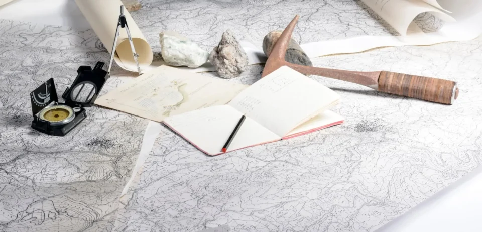
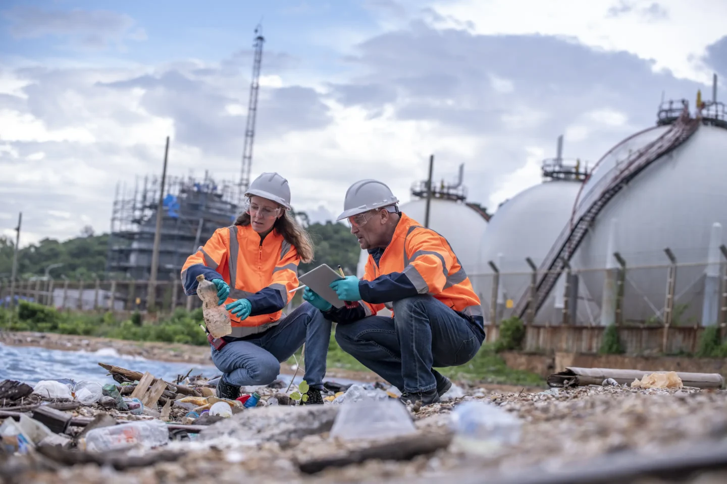
At Abbeydale Geoscience we like to help our clients from the very beginning! Ideally this would even be before applying for planning permission, so that we can feed into the preliminary design, where possible

The first things that we look at are the history, geology and environmental setting of a site, and build up an initial understanding, and what might need to be considered to further assess the potential risks.

A graphic for phase 1 desk study reports from Abbeydale Geoscience. We offer low cost phase 1 desktop studies in Yorkshire and the wider UK.

Phase 1 Desk Study

A Phase 1 Desk Study is an initial investigation into the history and environmental setting of a piece of land. It involves reviewing existing records, such as historical maps, geological surveys, and planning documents, to identify potential issues like previous industrial use, contamination, or unstable ground conditions. This study is typically the first step in a land development project and helps determine if further, more intrusive investigations are needed. It's crucial for understanding potential risks and liabilities associated with the site, informing the design and planning process, and ensuring the safety and suitability of the land for its intended use.

Core service level
We examine Phase 1 Desktop Study costs to produce a comprehensive Phase 1 Desk Study report.
Icon for flood risk assessment (FRA) & flood impact assessment (FIA) reports from Abbeydale Geoscience. Our expert consultants provide comprehensive flood risk reports, using flood risk studies and data from across the UK.

Flood Risk Assessment (FRA)

Flood risk assessments (FRAs) are reports evaluating the potential for flooding at a specific location, considering various sources like rivers, coasts, and surface water. Often required by local authorities for new developments, especially in flood-prone areas, FRAs help ensure buildings and infrastructure are designed to withstand floods. They identify risk reduction measures, such as raised floor levels or improved drainage, and inform emergency planning by highlighting potential hazards and aiding community preparedness.

Core service level
Professional flood risk assessments in Wakefield, West Yorkshire. Flood risk reports and cost available in the UK.
A graphic icon highlighting coal mining risk assessment (CMRA) & shallow mining risk assessment (SMRA) services in Yorkshire, carried out by our team at Abbeydale Geoscience.

Coal And Shallow Mining Risk Assessment

A coal mining risk assessment (CMRA) is a crucial evaluation of the potential dangers posed by past or present coal and shallow mining operations on a given piece of land. This assessment meticulously examines historical mining records, geological maps, and borehole data to identify specific hazards. Key concerns addressed in a coal mining risk assessment include the presence of abandoned mine shafts, adits, the potential for ground subsidence, and the release of hazardous gases. Particularly in regions with a history of mining, a thorough coal and shallow mining risk assessment is indispensable for any new development. By accurately identifying these risks, the assessment enables the implementation of effective mitigation strategies, safeguarding the structural integrity of buildings and infrastructure, and ensuring the safety of future occupants. The outcome of a comprehensive coal or shallow mining risk assessment directly impacts the planning and design phases of any project, making it an essential component of responsible land development in former mining areas.

Secondary service level
Coal mining risk assessment and reporting in Yorkshire. Abbeydale Geoscience offer a competitive cost for our mining risk assessments and can help you when you need it.
Water icon for soakaway assessment and sustainable urban drainage systems (SuDS) services from Abbeydale Geoscience. We carry out Infiltration Tests (Soakage Test or Drainage Test) and Soakaway Feasibility Studies in accordance with BRE 365.

Soakaway Assessment

A soakaway assessment determines if a site's ground conditions are suitable for a soakaway system, which manages surface water drainage. Knowing whether soakaway drainage might be an option for surface water drainage is a fundamental part of most developments, and to meet Sustainable Urban Drainage Systems (SuDS) requirements. It involves tests like percolation tests to measure how quickly water infiltrates the soil. This assessment is crucial for new developments, ensuring effective and sustainable drainage, preventing flooding, and complying with regulations. By assessing soil permeability and groundwater levels, a soakaway assessment helps design appropriately sized soakaways, minimizing the risk of waterlogging and environmental damage.

Secondary service level
Professional and cost effective Soakaway Investigation serving Leeds, Manchester, Wakefield, Scarborough, Bradford, Doncaster and the entire Yorkshire area.
An icon of a ground source heat pump (GSHP). The team at Abbeydale Geoscience help with ground source heat pump costs, assessment and installation setup.

Ground Source Heating Assessment

A ground source heating assessment evaluates the feasibility and efficiency of using a ground source heat pump (GSHP) system at a specific location. It involves analyzing geological data, including soil type, thermal conductivity, and groundwater conditions, to determine the ground's suitability for heat extraction. This assessment is essential for optimizing system design, ensuring efficient heat transfer, and predicting long-term performance. By understanding the ground's thermal properties and potential limitations, a ground source heating assessment helps determine the appropriate size and type of heat pump system, minimising installation costs and maximising energy savings.

Secondary service level
We look at the cost of ground source heating installation and how it can benefit you. If you require a ground source heating system in the UK, our engineers can help to explain how everything works and find you the best setup.
Icon highlighting geotechnical assessments and site investigation, including site soil analysis and investigation. Abbeydale Geoscience use these to create a geotechnical engineering report for our clients.

Geotechnical Assessment

There are many types of geotechnical assessments that we can assist with as geotechnical consultants. A geotechnical assessment evaluates the physical properties of soil and rock to determine their suitability for construction. It involves site investigations, including boreholes and soil testing, to analyse factors like soil strength, compressibility, and groundwater conditions. This assessment is vital for ensuring the stability and safety of structures, preventing issues like foundation settlement, slope failures, and ground instability. By providing detailed information on subsurface conditions, a geotechnical assessment informs foundation design, earthwork planning, and construction methods, minimising risks and ensuring long-term structural integrity.

Secondary service level
Abbeydale Geoscience carries out geotechnical assessments and slope stability analysis in Yorkshire and Lancashire. We serve Leeds, Manchester, Bradford, Wakefield, Doncaster, Sheffield, Scarborough and many more areas.

Investigation Services

The Next Step

At the investigation phase we focus on refining and better understanding the potential risks so that they can be quantified and accounted for. This makes the rest of the development process quicker, safer and easier to budget for.

Our ground investigations are tailored to provide the information that’s needed based on what we expect the ground conditions to be, and what the proposals are.

Icon showing phase 2 ground investigation, environmental site assessment (ESA) or contaminated land survey. Abbeydale Geoscience creates reports to ensure compliance and meet regulations.

Phase 2 Ground Investigation

A Phase 2 Ground Investigation is a more detailed, intrusive investigation that follows a Phase 1 Desk Study. It aims to confirm and quantify potential ground risks identified in the initial assessment. This involves on-site investigations, such as boreholes, trial pits, and soil and groundwater sampling, to gather detailed information about ground conditions. The Phase 2 site investigation analyses soil strength, contamination levels, and groundwater characteristics, providing data crucial for foundation design, remediation planning, and risk assessment. It's essential for ensuring the safety and stability of a development, and addressing potential environmental liabilities.

Core service level
Phase 2 Ground Investigation work in Wakefield, Yorkshire. An extractor is digging a large hole as part of a site investigation.
Icon showing coal and shallow mining investigation (also known as a geotechnical mining investigation and historical mining investigation). Abbeydale Geoscience investigate the impact of these on ground stability.

Coal And Shallow Mining Investigation

A Coal and Shallow Mining Investigation is a detailed on-site assessment that follows a desk-based review of potential mining risks. It aims to physically verify and quantify hazards associated with past coal and shallow mining activities. This investigation involves techniques like borehole drilling, geophysical surveys, and mine shaft inspections to gather subsurface data. The Coal and Shallow Mining investigation determines the exact location and condition of mine workings, assesses the potential for subsidence, and measures the presence of hazardous gases. This intrusive investigation is crucial for confirming the risks identified in preliminary studies, enabling the design of appropriate mitigation measures, and ensuring the safety and stability of proposed developments in former mining areas.

Secondary service level
Mining investigation, holding a lump of coal. Understand the risk of coal mining and shallow mining with our cost effective investigation.
Icon showing soakaway investigation / test to BRE 365 standards. This is also known as a percolation test, infiltration test, or groundwater infiltration test.

Soakaway Investigation

A soakaway investigation is a detailed on-site assessment to determine the suitability of a location for a soakaway drainage system. It goes beyond initial assessments by performing practical tests to verify ground permeability. This typically involves digging trial pits and conducting percolation tests, which measure how quickly water infiltrates the soil. The investigation also considers groundwater levels and potential obstructions. This practical, on-site investigation provides precise data for designing an effective soakaway system, ensuring proper surface water drainage and minimising the risk of flooding or waterlogging.

Secondary service level
A quality Soakaway Investigation for clients in Leeds, Manchester, Wakefield, Scarborough, Bradford, Doncaster and the whole Yorkshire area.

Remediation Services

The Last Step

The remediation phase starts by producing a Remediation Method Statement, outlining what needs to be done to remove or mitigate the potential risks to future site users. This needs to be approved before any remediation works commence.

During construction works we can then carry out validation works to make sure that things are done as agreed. Keeping on top of things as they’re happening on site is key to making sure that the information needed for the final Verification phase is easily available.

Icon showing a remediation method statement, or remediation action plan (RAP). It can also be known as an environmental remediation plan or a contaminated land remediation strategy.

Remediation Method Statement

A Remediation Method Statement details the planned procedures for cleaning up contaminated land or addressing ground instability. They outline the specific techniques, equipment, and safety measures that will be used to remove or treat pollutants or stabilise unstable ground. These statements are crucial for ensuring that remediation work is carried out effectively, safely, and in compliance with environmental regulations. They typically include details on site preparation, excavation, treatment processes, waste disposal, and monitoring, providing a step-by-step guide for contractors and regulators. Remediation Method Statements are essential for minimising environmental impact and ensuring the long-term safety and suitability of the site for its intended use.

Core service level
Remediation method statement services from Abbeydale Geoscience. Image shows an oil spill.
Icon for geotechnical and geo-environmental validation services. Abbeydale Geoscience creates a geotechnical site investigation report (GIR) to identify potential hazards.

Geotechnical And Geo-environmental Validation

Geotechnical Validation and Geo-environmental Validation are crucial steps in ensuring that ground remediation and construction activities meet the required standards and specifications. Geotechnical Validation focuses on confirming that the ground conditions after construction or remediation align with the design assumptions. This involves verifying soil compaction, foundation stability, and slope stability through on-site testing and monitoring. Geo-environmental Validation, on the other hand, verifies that any remediation of contaminated land has been successful and that the site meets the agreed-upon environmental standards. This includes confirming the removal or treatment of pollutants through sampling and laboratory analysis, ensuring that the site is safe for its intended use and complies with regulatory requirements. Both validation processes provide documented evidence that the work has been completed to a satisfactory standard, reducing long-term risks and liabilities.

Core service level
Geotechnical and geoenvironmental specialists, offering validation services in Yorkshire and across the United Kingdom.
An icon to highlight geotechnical and geo-environmental verification services from Abbeydale Geoscience. These may also be called foundation compliance testing, earthworks verification, or land quality assessment.

Geotechnical And Geo-environmental Verification

Once Validation works have been completed the findings and confirmatory results are compiled into a Verification report. Geotechnical Verification and Geo-environmental Verification are processes that confirm that completed groundworks and remediation efforts meet the project's design specifications and regulatory requirements. Geotechnical Verification ensures that the physical properties of the ground, such as compaction, strength, and stability, align with the design parameters. This involves on-site testing and monitoring to validate that foundations, slopes, and earthworks are constructed as intended, ensuring structural integrity. Geo-environmental Verification focuses on confirming the effectiveness of contamination remediation. It involves sampling and analysis to verify that pollutants have been adequately removed or treated, meeting environmental standards and ensuring the site's safety for its intended use. Both verification processes provide essential documentation, demonstrating that the project has been carried out to the required standards and reducing potential long-term risks and liabilities.

Core service level
Verification report and costing in Wakefield, Sheffield, Doncaster, Leeds, York, Bradford, and all of the Yorkshire areas.
All Content © 2025 Abbeydale Geoscience